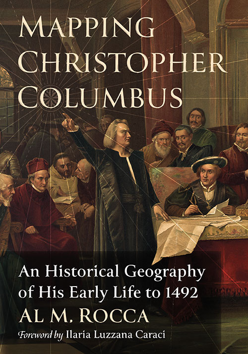
Mapping Christopher Columbus
An Historical Geography of His Early Life to 1492
$49.95
In stock
About the Book
The impact of Christopher Columbus’s first transatlantic voyage launched an unprecedented explosion of European exploration. Throughout the last 500 years, scholars have recognized this transforming event, and they have written extensively on the subject. To date, no American author has dedicated a book to Columbus’s life before 1492. This biography does so, with a focus on geographical experiences that affected his formulation of a transatlantic concept.
Incorporating extensive research from American and European scholars (historians, geographers, anthropologists, and cartographers), the author proposes that Columbus systematically built a transatlantic voyage proposal from knowledge gained on previous voyages in the Mediterranean Sea and Eastern Atlantic Ocean. The book’s extensive use of maps place Columbus’s actions on specific land and ocean locations. Persons interested in gleaning more information about Columbus’s maritime background will find a plethora of maps to visualize the extent of his early travels.
About the Author(s)
Bibliographic Details
Al M. Rocca
Format: softcover (7 x 10)
Pages: 260
Bibliographic Info: 92 maps, notes, bibliography, index
Copyright Date: 2023
pISBN: 978-1-4766-8755-1
eISBN: 978-1-4766-4806-4
Imprint: McFarland
Table of Contents
List of Maps vii
Foreword by Ilaria Luzzana Caraci 1
Preface 3
Introduction 7
1. Youth and Early Adventures, 1451–1476 13
Young Columbus in the World of Genoese Mediterranean Mercantilism 13
The Expanding Mediterranean World of Columbus 17
Columbus Enters the Atlantic Ocean 23
2. The Ottoman Threat, 1453–1481 29
Muslim (Ottoman) Expansion in the Eastern Mediterranean 29
Genoese Colonies in the Black Sea Fall to Ottomans 33
Ottoman Atrocities and an Attack on Italy 34
3. History of Atlantic Exploratory Expansion 39
Atlantic Exploratory Voyages, Stage 1: Phoenician 39
Atlantic Exploratory Voyages, Stage 2: Roman Expansion of the Mediterranean and Extension into the Atlantic 40
Atlantic Exploratory Voyages, Stage 3A: Medieval (Vikings) 43
Atlantic Exploratory Voyages, Stage 3B: Medieval (Genoa and Venice) 48
Atlantic Exploratory Voyages, Stage 4: North Atlantic Fishing and Zones of Opportunity 50
4. Columbus Explores the North Atlantic, 1476–1478 55
Columbus in Portugal and His Life in Lisbon 55
Columbus Sails North to England, 1476 or 1477 57
Columbus and the Five Zones of Habitation 59
From England to Iceland and Beyond, 1477 60
Did Columbus Sail to Iceland? 65
Is Thule Really Greenland? 68
The Problem with Ancient and Medieval Translations 71
5. Marriage, Madeira, Porto Santo, and the African Coast, 1478–1481 76
Columbus Heads South 76
Columbus Marries 78
The Importance of the Islands of Porto Santo and Madeira 79
The Enterprise to the Indies Is Conceived 83
1482 and the Psychology of Discovery 86
The African Coast, São Jorge da Mina, and the Equatorial Region 88
The Alonso Sánchez Mystery, 1482 94
6. Columbus and Slavery Before 1492 100
Questions to Frame the Discussion 100
Slavery in the 15th Century 100
Columbus’s Early Experience with Slavery 103
New World Indigenous Slavery Before Columbus 109
Columbus and Slavery, 1492 117
7. The Toscanelli Map and King João II (Portugal), 1483–1485 124
Columbus Builds a Transatlantic Concept 124
The Toscanelli Letter and Atlantic Geography 126
Portuguese Atlantic Exploration 128
Muslim Expansion in Africa and King João’s Response 133
8. Columbus Builds His Cartographic Support 138
Christopher and Bartholomew Columbus’s Mapmaking Business 138
The Ptolemy World Map and the Size of Asia 139
1452 Leardo Map 144
1457 Genoese Map 149
1459 Fra Mauro Map 151
Toscanelli Map and the Small Earth Concept 152
Antillia and the Pareto Chart 155
9. Columbus Wins Approval from King Ferdinand and Queen Isabella, 1485–1492 158
Columbus Moves to Spain 158
Columbus Meets Ferdinand and Isabella Again 160
Columbus Back in Portugal and the Dias Voyage 162
Friar Juan Pérez, the Martellus Map, and the Behaim Globe 165
The Columbus Plan and Atlantic Zones of Opportunity 169
A New Plan and a New Approach, 1489–1492 175
Expected Zones of First Contact 184
10. Columbus’s Geographic Perspectives on the Eve of His 1492 Voyage 188
Columbian View of the Atlantic World 188
Perceptions of a Columbian Exchange 195
A Future for Social Globalism 200
The Problem of Geographic Complexity 204
Acknowledgments 211
Chapter Notes 213
Sources and Bibliography 235
Index 243
Book Reviews & Awards
• “Rocca’s book focuses on Columbus’s life and voyages prior to 1492 with the goal of determining how his idea of sailing west to reach Asia originated and evolved. … [He] contends that Columbus, during his voyages in the Mediterranean Sea and the Atlantic Ocean, used his observations to develop a model for how the winds and currents circulated. This knowledge made sailing west across the Atlantic to reach Asia feasible… Rocca draws on many primary and secondary sources to support his conclusion…persuasive…recommended”—Choice
• “Mapping Christopher Columbus is a valuable addition to the literature. In great detail, Rocca explains how Columbus became certain that he could reach the Orient by sailing west.”—Simonetta Conti, professor emeritus, University of Campania, Italy
• “By showing the evolving conceps of geography available to Columbus, Rocca’s Mapping Christopher Columbus provides a wonderful background to his voyages. It should be read by all those interested in the man.”—Carol Delaney, author, Columbus and the Quest for Jerusalem
• “Rocca demonstrates through in-depth analysis that it was essentially the navigation experiences before the first transatlantic voyage that allowed Columbus to build and improve, little by little, his project Mapping Christopher Columbus is a new, significant, and useful contribution to Colombian historiography”—Ilaria Caraci, University of Rome, Tres
• “Rocca does an excellent job showing the moral quagmire in which Columbus found himself. Here I see a man with a moral compass having to deal with the Amerindians’ cultural history of slavery, the destruction of La Navidad, and Spanish leaders entrusted to carry out Columbus’s rule to treat natives fairly and humanely.”—Robert Stevens, University of Texas at Tyler
• “Rocca identifies the most scientifically significant topics and expresses even difficult ideas with clarity; even the geographical maps that accompany the text are excellent from every point of view: clear, easy to understand and created with great geographical competence.”—Carla Masetti, University of Rome, Tres
• “A valuable addition to the literature about Columbus. I have read [Samuel Eliot] Morison’s book and the works of many others, but none of them fully explain how Columbus became so certain that he could reach the Orient by sailing west. You do.”—Joe Scafetta, author, The True and Complete Story of Christopher Columbus

